The Machu Picchu hike
We recently did the Classic Inca trail hike that ends at Machu Picchu in Peru. It’s an awesome trek and we really enjoyed it. We found it hard to find information & learnt a few things as part of the trip. Hence this blog to give back to the world’s repository of free and authentic information.
Here I try to answer questions like, how was the hike? what did you enjoy the most? How difficult/easy it is? How is the camping arrangements etc etc.
What is Machu Picchu & the Inca trail hike?
There is a ton of information on the internet so I will keep this brief. Machu Picchu is an ancient city built by the Incas (13th century) in the heart of Andes. The ruins of the city is an archeological marvel and a beautiful place to visit.

The Inca trail hike is following the trail built by Incas (originally as a pilgrimage route) to reach the sacred city of Machu Picchu (dotted line in the picture below. courtesy https://www.salkantaytrekking.com)

General Layout of the trek: The trek rated as “moderate” is about 45Kms on a stone & dirt trail in the Andes, built by the Incas themselves and reaches the highest elevation of 4200m. The trail takes 4 days to cover and passes through several Inca ruins on the way including the Sun gate before ending at the lost city of Machu Picchu.
Alternatives: There is a 2 day Inca trail or the Salkantay trail, a trek in the same region of Andes but not on the trail built by Incas. You can also simply take a train/bus to the Machu Picchu Inca site. This website has good information about all the trails with maps.
Classic Inca trail hike: What to expect?
It’s a walkable path all the way with no steep inclines or big boulders where you need additional agility/assistance to climb. If you are into any kind of endurance sports, even at moderate level, you do not have to worry. If you are not into any cardio routine but are generally healthy and walking long hours doesn’t daunt you, it can be hard at times but doable.
We had hikers of all ages (seniors, students, youngsters, middled aged and our own teenager) all shapes ( fit, over weight, just regular sized). Everyone followed their own pace and completed the hike. Nobody went back!
There were few couples & families but the prominent theme was group of friends! More women-only than mixed. There were more women (of all age and shape) than men and few women guides too. Yet, the number of men’s toilets were more (Typical!!!).
Altitude sickness can affect anyone, fit or otherwise. Its usually headache and in rare cases nausea. Climbing high & sleeping low helps the body cope better. Cusco is at 3300m and your first camp at 2800m helps. When you climb to 4200m try not to linger if you are not feeling great.
You can also check out off-the-shelf medicines (for altitude sickness, anti-diarrhea etc.). The tour operators do suggest what to carry, just in case.
Focus on hydration throughout the 4 days, carry electrolyte powder if you are worried about cramping. The food served is a mixture of familiar food (eggs, pasta, bread, rice, vegetables and meat ) and local dishes/soups. Carry trail mix /energy bars that you are used to if you feel the food may not suit you. Our group did not eat any type of meat and we enjoyed the food served.
Only the first camp has electricity/charging option available (you need your own plug and cable & pay few soles). No mobile signal on day 2 and day 3. Check out solar charger option (we saw couple of hikers use them).
Here is a day by day account of a typical experience.
Day 1 has 2 parts. Travel to the Inca trail start gate, and the trek itself.
Part 1: Getting to the basecamp
Your day would start early around 5AM when your tour operator picks you up from your hotel in Cusco to the starting point of the trek, 82KMs away.
You will most likely have a breakfast stop on the way at Ollantaytambo. I am from Bangalore, a place known for its really temperate weather so it was bbrrrrrr… and I had 5 layers on me. However, I am a bit of a drama queen so decide for yourself. We hiked in May and the temperature during the day ranged from 8–25 degree Centigrade and was close to 0 on the coldest night.

As you enter through an official gate, your trek starts. The porters follow the same route but are much (much much) faster than you, so keep a day pack to carry your layers as you shed them, for water and snacks for the road.

You will be accompanied by a guide who will answer all your questions about names of the mountains, flora, fauna, the history and what is known about the Incas and the different ruins you will pass through. They will also keep you on the track, plan your lunch breaks and decide what time you need to start in the morning by observing your pace on day 1.
Part 2: The first day on the Inca trail.
It’s a warm up hike (read easy) that introduces you to the great Andes. You tread 10+ amazing KMs. We started at ~10AM & ended by ~5PM with a lunch break in between.

We recorded the whole trek on Strava (cheap thrills) which works perfectly fine in airport mode. Plan for battery consumption if you wish to do the same.

As you start walking and the sun comes out, your layers come down so have enough room in your bag.

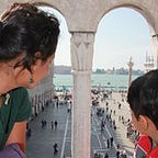
We were given a fruit & a cookie as snack pack and you get to eat them in such nice resting places on the trail. This is our group. Dhruva (15), Sandy (with sandals), Ajit, Deepa and me Chetana, the picture taker. D, A & D are first timers with no prior multi-day or high altitude hike experience.

This is our first Inca site. Saw it from above which helps to get the big picture. One of the settlements where they have built it like a snake head to slow down the river Urubamba. The upper region of bigger houses is for the rich and the lower buildings are to be habited by the commons (Ivory towers existed before flush toilets). Steps and water makes agriculture possible.

This is where we camped for the night. In a village called Hyullabamba. The whole region, the Inca trail passes through, is protected and no settlements are allowed. However, families farming for ages are permitted to continue. They can only inherit, cannot sell the land or have tenants. This camp is in the backyard of such a farmer’s family who were having a drinking party to celebrate Mother’s day that night :)
There was electricity and can you hear this: Wi-Fi!! Don’t expect any of this in the upcoming campsites.
One thing you need to get used to is the toilet situation. We had access to the one belonging to the farmer’s family in this campsite. More are available through the trail every few KMs. Few good (costs 2 soles), some bad, others worse :). You should know that toilets do not come with seat covers and sometimes are squatting ones. Running water is always available though which guarantees basic cleanliness. Sometimes the doors are get-your-own-latch kind with 2 loops expecting you to put a rod between them.

Sleeping bags were rented and were really warm but not freshly washed (as promised) but they came with freshly washed cloth liners. I recommend change your clothes for the next day before “going to bed”. It’s also totally ok to wear the same clothes for the next day. And keep those shoes inside else they will get wet with dew.
Day 2 hike is the hardest of all the 4 days. 15.5KM, steepest climb to reach the highest altitude of the trek (4200m) and descend to 3600m.

Our wake up call was at 4:30AM with a bowl of warm water to freshen up. There will be a place to brush/wash (a cold water tap with wash basin) in every campsite.
You reach the camp between 4–5PM, sun sets immediately after, other than a leisurely dinner with ample chit chat, star gazing there is not much to do. So sleeping early, waking up early is not a problem.
Once we were done with the morning ablution, breakfast (egg sandwich, hot tea among other things) was served, water bottles filled, snack packets given and we were ready to start at 6:30AM. Depending on our pace, today’s lunch would be before the highest point or after crossing it (preferred).


I was hearing the perfect background music played by this little stream for a long time as I walked alone before seeing it up and close. We all mostly walked in solitude, occasionally striking conversations with a fellow trekkers.

These 2 did the hike that day by sheer grit. I am sure the waterfall in the background helped a little :)

We camped early at Wyllabamba for lunch as A was struggling and the guide did not rule out the option of turning back (they take altitude sickness seriously). If we proceed from here, there will not be any option to turn back (which means walking all the way back. No short cuts).
Most others camped here for lunch too. Only few groups halted for a while and proceeded further without. We bought Gatorade from an old lady because D didnt like the plastic smelling water.

The mountain behind looks like and hence the name, Dead woman’s pass. As explained by another guide to his group: “Can you see the left breast of the woman, the nipple is the highest point we reach before descending”

When the going gets tough, the tough gets going. Kudos to A and D for not giving up. A (who also my kid brother) and I had a great time talking about our growing up days while walking very very slowly. The tiny hat in the picture is me by the way :)

And reached we did!! (which was only half way, but the rest is descending)

The descent and a glimpse to the stone path.

The post sunset view at our campsite was amazing.
I barely saw this, as few minutes after reaching the camp, I developed headache and nausea ( I promptly vomited) and I retired to the tent. Everyone else, though tired, were ok and had popcorn with tea followed by dinner. I am not sure if my condition was due to altitude (I became sick after descending) or simply a case of bad stomach.
The guide and the porters are not allowed to give any kind of medicine. So, they ask you to keep pack essentials and take as you need. Ajit & Deepa took magnesium tablets to avoid cramps, mild paracetamols to sleep better.
Day 3 was a day we walked above the cloud, experience the rain forest and its colourful carpets of moss. 17km with 600m elevation gain (though we mostly descended). Not as hard as day 2. Not as easy as day 1.


The guide insisted on this picture where you can see the Inca site behind. That is where we were heading. An interesting site where Astrologers, doctors and such intellectuals resided. It is built to be able to observe the movements of the sun, moon and the stars.


We climbed a hillock called Runkuraqay to get this view that was totally worth it. It felt like being on top of the world with amazing views all around.

It was a rain forest so it rained (just a drizzle though). The ponchos we got for 7 soles came in handy.

This is how a lunch is. This day, as we had lunch, it poured outside! Lunch and Dinner are always 3 course meals. Soup, entrée and main course followed by tea with milk powder or green. They make it a point to decorate the food too. We ate the oranges and carrot bunny! :D

The cooking place is smaller than our eating place with a partition in between. Your clothes will smell of food but I dont have a heart to complain. Except for the water bottles (those are ours), porters carry everything you see in the picture. I seriously feel we can do with a lot less!


We traverse the mountain in such a way that we see a lot of valleys this day.

We end the trek with this Inca site. Its just a settlement (a village or sorts). Each of these steps are more than 10ft tall. The camp is another 15 minutes away. We chose a further camp, hence the 17KM stretch, to make sure we don’t have to wake up at 3AM the next day.

The last camp was near the forest ranger’s housing. There was a bright moon that night. Phone camera doesn’t do justice (lights up more than necessary).

This would be the last sit down meal as the porters would go their own way to catch the train back in the morning giving us packed breakfast. Cannot believe they made a cake for us!
The last day of the trek includes going to the Sun gate and then descending to the lost city of Incas in Machu Picchu where the trek ends but there are more things to do. Day 4 would have 4 parts.
Part 1: Waiting at the control gate and racing (optional) to the Sun gate
The day would start early. The wakeup call was at 3:30AM, we packed our bags one last time and were out by 4AM. To walk about 100–200m & stand in line at the control gate that opens at 5:30AM. There is a shelter for the early birds that we just missed. As we waited, we could take turns and walk back to the camp for morning ablutions. Between that and listening to the boisterous English group next to us, the time passed itself.

The gate opened exactly at 5:30AM and the line moved pretty quickly too. In no time we had shown our passports and were out. View(s) of this amazing sunrise is the reward for getting up early.


This is a simple click on the phone camera. You can imagine the live scene.

I wasnt joking when I said, “racing” to the Sun gate. Some of the groups picked up pace we didnt know why but we joined. The path only allowed a single file so if you stop to remove a layer (we were practically running) or tie your lace, you lose your position. I removed my jacket and put it back in the bag in record time but still lost sight of Dhruva.

The idea is to reach the Sun gate that provided a superb view of Machu Picchu to see the sun rays fall on the hills progressively (at least my deduction). We reached when only farthest mountain was lit.
If you ask me, the running was completely optional. Ajit and Deepa walked at their usual pace and reached 15 minutes later and didn’t miss anything :P
So while you are doing the whole hike, there are several other groups doing the same. However, since the number of hikers are limited (~150) and porters travel in groups & quickly, you encounter others only once in a while in your journey. Camps far enough from each other to give you privacy, so your interactions are limited to exchanging few words while standing in line for the loo. Yet, you would have spoken to some and many more faces are familiar. You will meet all of them here at the sun gate and every one is jubilant. The camaraderie of achieving a common goal even by travelling side-by-side is magical. We congratulated each other and bid goodbyes like friends.
Part 2: Finishing the last leg and reaching the Lost city of the Incas

The path you see in the above picture is what we need to take to reach the Inca site in Machu Picchu. Its another 3 KM.

3 of us had signed up to climb another hill (montana Machu Picchu) the same day (completely unnecessary, impractical & crazy plan) and the entry gate closes at 9AM so we ran AGAIN.

The Inca trail final destination is where the Red line meets the White line in the picture above. Ignore the continuation and the elevation gain. That’s part of the crazy plan that I do not recommend (unless you too are crazy like us :)
Part 3: Guided tour of the Inca city

Once done with the trek, you reach the ruins. You can take the tour of the site right away or go outside, use the clean rest rooms, drop the bags at the cloakroom, have lunch and comeback to do the guided tour of the Inca site (recommended). Your tour operator would have pre-booked the ticket for the Inca site. Double check if a re-entry is allowed.
The guided tour is marked in 4 zones. Zone 3 covers the basic / heart of the ruins and is the smallest option. Others add one or more additional areas. Our ticket was Zone 3. Your guide for the hike will be your guide here too. Make sure to check his availability if you want to come back later. There are also guides your can hire on the ground but are expensive.

Since we went to climb the Montana Machu Picchu (with the extra people in the picture), the 3 of us missed the guided tour. We walked around and enjoyed the feel of the ancient city.

And finally, we headed back reluctantly bidding adieu to the gorgeous mountains.
Part 4: Taking the bus to Aguas Calientes and then train back to Cusco

Once done with the Inca site visit, we took the bus to reach Aguas Calientes, spent some time at the city centre before taking the train back to Cusco. The bus ride costs USD12. The alternative is to walk (60–90 min) but hey! the hike is over :)

Don’t forget to get your passport stamped at the government office (optional) to commemorate the wonderful experience. The place is few meters from the bus stop. Just ask someone and they will show you.